
Professor Doug Garnar donated this 1857 map to the college.
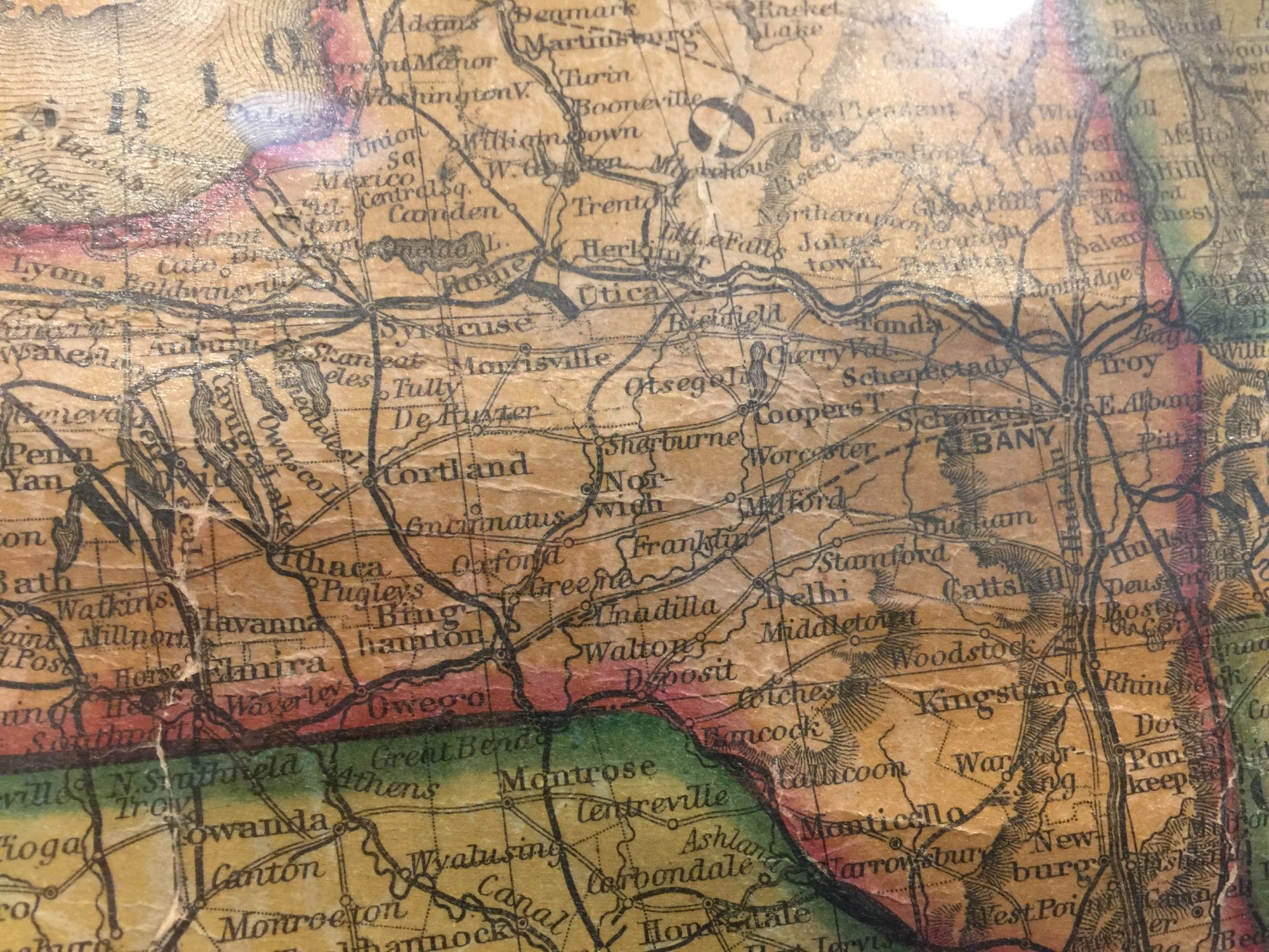
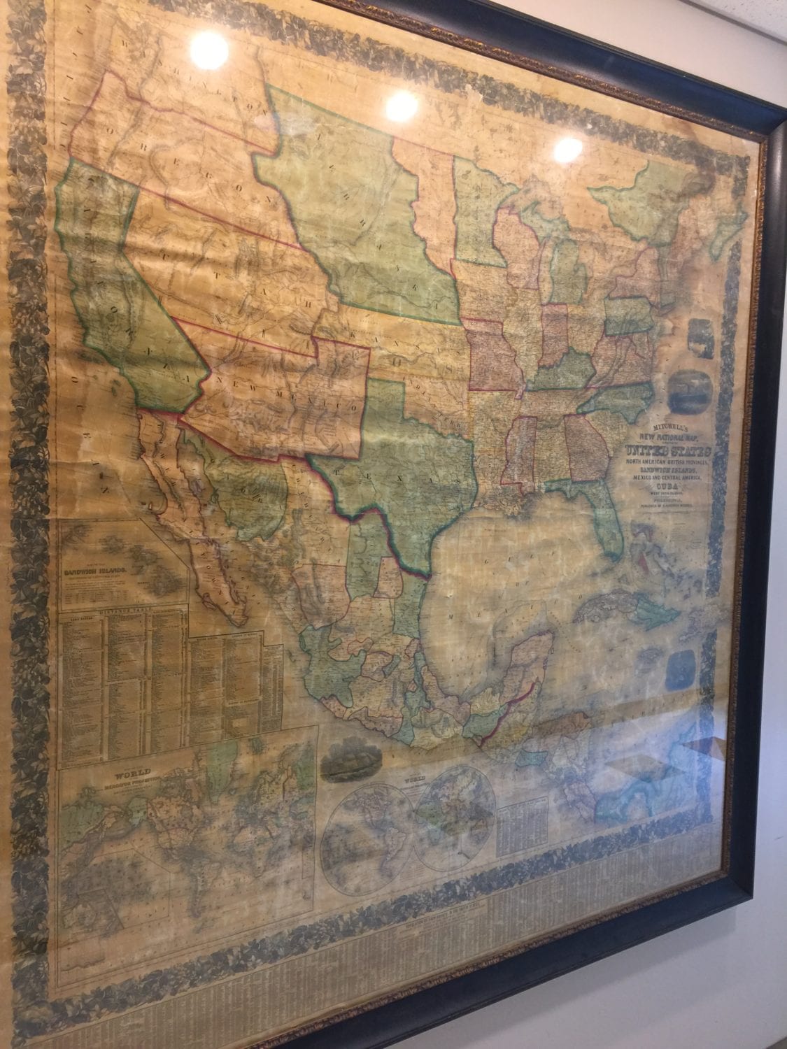
Created in 1857, the colorful map on the wall of Titchener Hall has some familiar spots. States in the Northeast have their usual shape, and New York even contains familiar communities: Binghamton, Walton, Owego.
But there the familiarity ends. West of the Mississippi, the country is largely carved into huge blocks of territory, with “Nebraska” stenciled across much of the Midwest. Above Texas, a block is labeled “Indian Territory,” a reflection of former President Andrew Jackson’s tragic relocation of the Cherokee via the Trail of Tears.
The antique – and genuine – map was donated to the campus by Professor Emeritus Doug Garnar, adding to a collection of historic maps in the first-floor hallway.
Professor Garnar, who began teaching at the college in 1971, received the map in the early 1980s from a man who purchased a long-time store in Smithville. Back in 1972, Garnar had purchased a historic schoolhouse in Smithville, which he turned into the family home; the school, which closed in 1959, had 100 children and four classrooms in its heyday.
The 1857 map is on display on the first floor of Titchener Hall.
He considered installing the map on the second floor of the schoolhouse, stored it in the attic for safekeeping – and promptly forgot about it. He rediscovered it when he was preparing his house for sale and contacted the Broome Community College Foundation about donating the item to the college.
“In good condition, it’s worth $2,500 to $3,000,” he said.
He encouraged other faculty and staff members with interesting bits of material history to consider donating them to the college, where they can continue to educate students.
“I immediately saw the pedagogical value of the map,” said the retired professor, noting its possible uses in world history, American history and sociology classes.

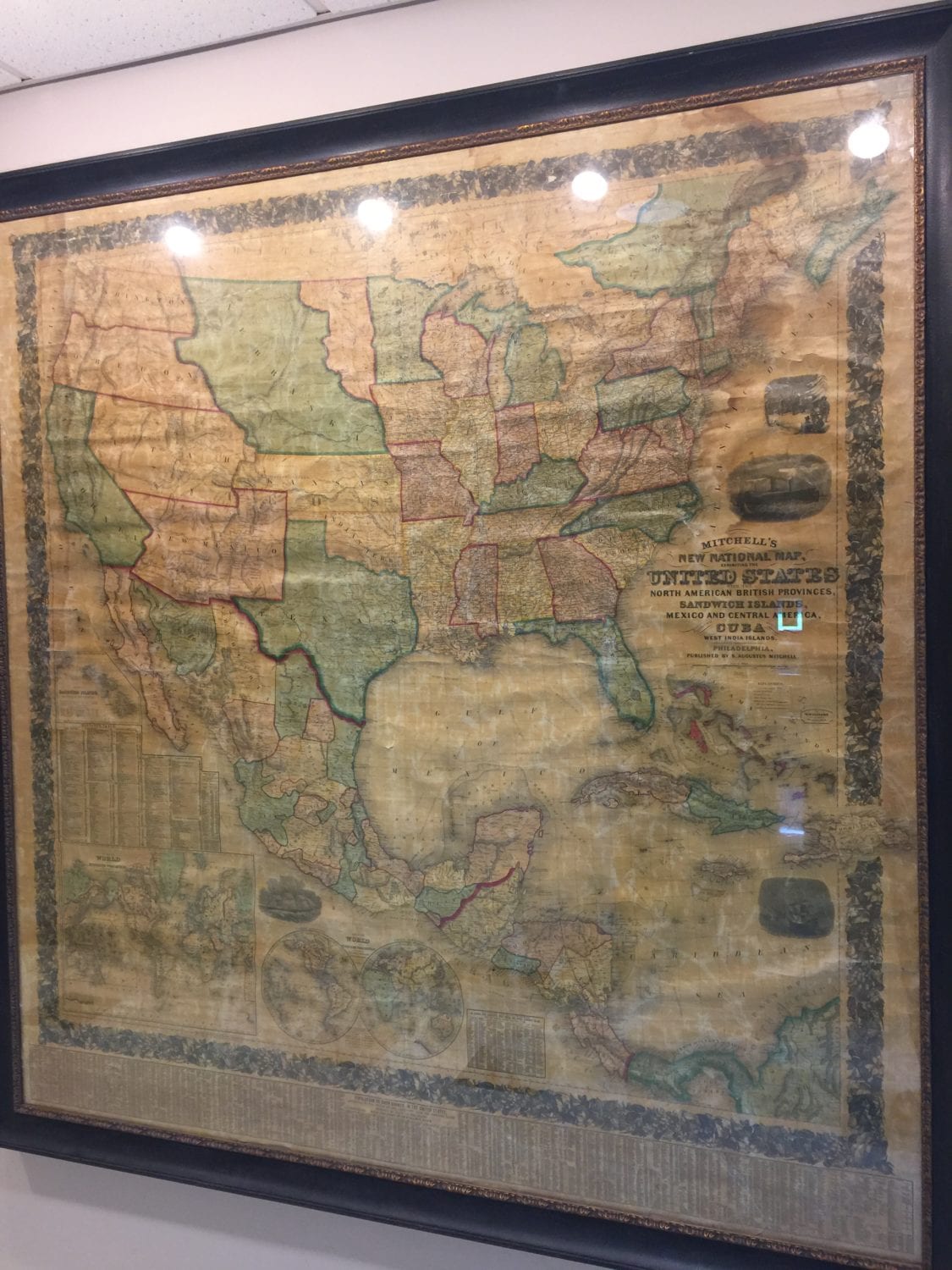
The map includes census data from all U.S. counties in 1857.
The world back in 1857
A little over 5 feet wide and 5 feet long, the antebellum map was created by S. Augustus Mitchell.
“The guy had apparently been a school teacher and was very irritated by the poor quality of maps and went into cartography. He was the go-to person for schools, libraries and government entities,” Garnar said.
There is no Hawaii; the islands are there, true, but they’re called the Sandwich Islands. The smaller inset world map shows only a few labeled areas in Africa, with most of the content marked “unexplored.” At the bottom is a list of all the legal counties in the U.S., with census data from 1850 and 1855. Broome County had 30,660 residents in 1850, rising to 36,650 in 1855, according to the map’s data.

An information panel from the 1857 map.
It turns out that 1857 was an interesting year. James Buchanan became president that March. The National Deaf Mute College – known today as Gallaudet University – became the first college for the deaf. Elizabeth Blackwell, the first woman to receive a medical degree in the United States, opened a hospital in New York City. Also in the Big Apple, the first elevator was installed. Later that year, the first worldwide economic crisis – the Panic of 1857 – began.

A view of Upstate New York, circa 1857
In perhaps the most famous incident of the year, the Supreme Court issued the Dred Scott decision, in which the court ruled that people of African descent were not and could not become American citizens – in essence, that “slaves were simply property and property needs to be returned,” Garnar explained. Historians consider it the worst decision ever rendered by the court.
Also that year, the U.S. Army fought the Seminole Indians in Florida and the Mormon settlers in Utah. The nation lurched slowly and perhaps inevitably toward civil war, following the compromises of 1820 and 1850.
As settlements moved westward and territories applied for statehood, the question was whether they would permit or ban slavery, Garnar noted. The issue led to widespread violence in what was known as the “Bloody Kansas” crisis between 1854 and 1861, when Kansas was admitted as a free state.
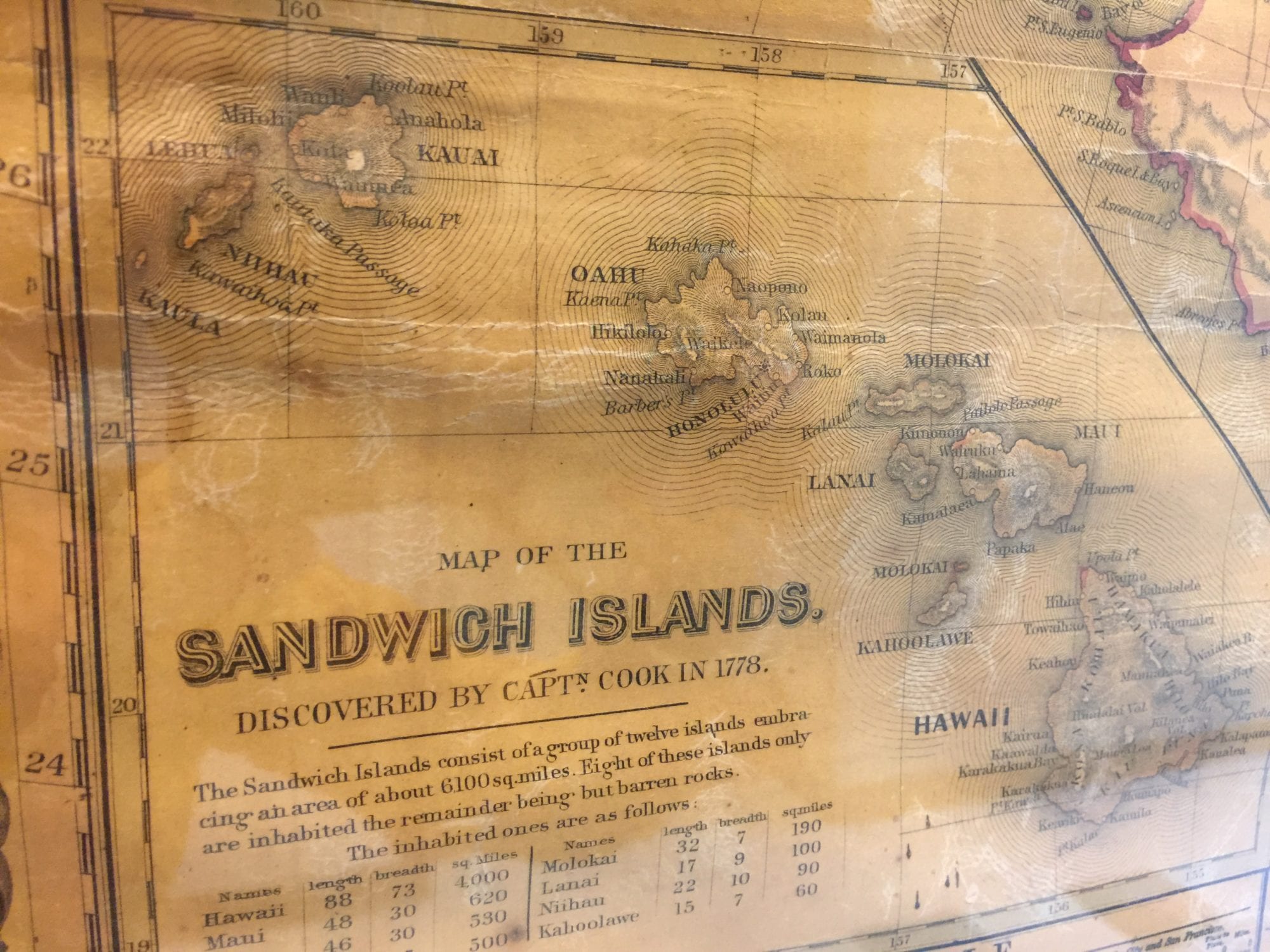
Many years before it became a state, Hawaii was known by a different name.
One proposed solution at the time was to head southward into Central America and carve out future slave states, keeping the western states free.
“The plan never moved beyond the talking stage,” Garnar noted.
